


|
시장보고서
상품코드
1624575
유럽의 LiDAR : 시장 점유율 분석, 산업 동향 및 통계, 성장 전망(2025-2030년)Europe LiDAR - Market Share Analysis, Industry Trends & Statistics, Growth Forecasts (2025 - 2030) |
||||||
■ 보고서에 따라 최신 정보로 업데이트하여 보내드립니다. 배송일정은 문의해 주시기 바랍니다.
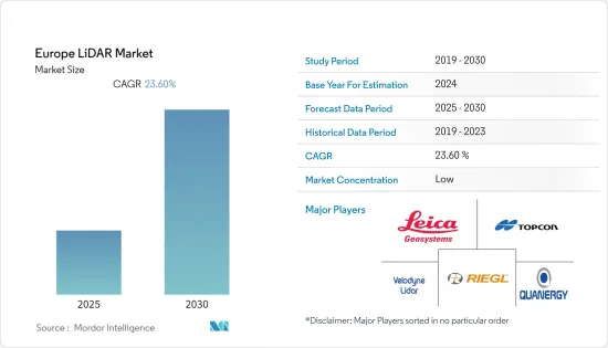
유럽의 LiDAR 시장은 예측 기간 동안 23.6%의 연평균 복합 성장률(CAGR)을 나타낼 것으로 예상됩니다.

주요 하이라이트
- LiDAR 기반 매핑 솔루션은 민첩성이 뛰어나 고정식 및 이동식 차량에서 모두 사용할 수 있습니다. 이 때문에 많은 산업, 특히 엔지니어링, 건설, 환경, 탐사 등의 분야에서 채택되어 그 효과와 수요를 입증하고 있습니다. 이 기술은 군용으로 발명되었지만, 2010년대 초에 구름을 연구하는 기상학자들이 처음으로 광범위하게 채택했습니다.
- 각국 정부는 항공 LiDAR 개발 기술에 적극적으로 투자하고 있습니다. 영국 정부는 지난 17년 동안 LiDAR 데이터를 수집해 일반에 공개하고 있습니다. 정부 대변인은 이 데이터가 고고학자들이 고대 경관을 시각화하는 데 도움이 될 수 있다고 주장합니다.
- 또한 프랑스 정부는 자율주행차 개발을 지원하고 있으며, 2020-2022년 사이에 '고도로 자동화된' 차량을 공공 도로에 배치하는 것을 목표로 하고 있습니다. 정부는 자율주행 대중교통의 이용과 3단계 자율주행차량의 유통을 가능하게 하는 법규를 제정하는 것을 목표로 하고 있습니다.
- 그러나 이 시장은 상대적으로 높은 장비 및 측량 용도 비용과 이 기술에 대한 교육 및 인식 부족으로 인해 시장 성장에 걸림돌이 되고 있습니다. 그러나 조사 대상 업체들의 기술 혁신이 진행됨에 따라 가격이 낮아지고, 이 기술의 상업적 범위가 더욱 확대될 것으로 예상됩니다.
- 코로나19는 전 세계 산업계에 영향을 미치고 있습니다. 자동차 산업은 LiDAR의 중요한 채택 기업 중 하나입니다. 이번 사태로 인해 다양한 생산 공장이 가동 중단을 강요당하고 있습니다. 유럽자동차공업협회(ACEA)에 따르면, 공장 가동 중단으로 인한 자동차 산업의 지역 전체 생산 손실은 승용차, 트럭, 밴, 버스, 버스, 코치 등 최소 244만 6,344대에 달한다고 합니다.
유럽 LiDAR 시장 동향
엔지니어링 산업이 큰 시장 점유율을 차지합니다.
- 측량 및 토목 공학은 기존 건물과 경사면의 안정성에 대한 세부 사항 및 기타 요인에 대한 귀중한 통찰력을 제공하기 위해 항공 및 지상 스캐닝을 위한 LiDAR 기술에서 중요한 의미를 발견하고 있습니다.
- UAV(무인항공기)는 위험지역에서 고정식 솔루션을 사용하는 기술자들이 직면한 문제를 해결하기 위해 측량 용도로도 사용되고 있습니다. 또한 LiDAR 기술이 탑재된 헬리콥터와 비교했을 때 비용 절감 효과를 고려할 때, LiDAR와 통합된 UAV의 보급이 예상됩니다.
- 지상 기반 LiDAR의 원격 조작은 암반 특성 평가 및 경사면의 안정성을 위해 암반 역학을 모니터링하기 위해 당국의 안전한 위치 조사를 더욱 확실하게 보장합니다. 지오메카닉스의 세부 사항은 도로 및 기타 지상 교통 수단을 놓을 수 있는 안전한 장소를 설정하는 데 매우 중요합니다.
- LiDAR은 철도 산업에서 효율적인 자산 관리를 위한 자산 건전성 보고서 모니터링과 승객 수송량 증가에 따른 노선 상태를 평가하는 정부 당국의 책임에 널리 사용되고 있으며, LiDAR은 강바닥의 깊이와 흐름의 강도를 파악하여 댐 및 기타 유량 제어 구조물을 적절히 설계하는 데 자주 사용됩니다. 유량을 제어하는 구조물의 적절한 설계를 위해 자주 사용되고 있습니다. 또한, 빗물 및 홍수 관리 시스템 설계에서도 환경 재해로 인해 발생할 수 있는 문제를 분석하는 데 도움이 되기 때문에 중요한 역할을 하고 있습니다.
- LiDAR의 안전하고 간편한 작동에 대한 인식이 각 지역으로 확산됨에 따라, 건설 및 수리 응용 분야에서 LiDAR 제품 및 기술의 사용은 예측 기간 동안 증가할 것으로 예상됩니다. 또한, 건설 분야에 항공 LiDAR를 사용하는 것은 사진 측량(고해상도 카메라에서 수집한 데이터를 사용하여 해당 지역의 2D 또는 3D 측량을 생성하는 것)과 같은 다른 방법보다 선호되고 있습니다.
- 또한, 이 지역의 건설 건수 증가는 LiDAR 시장의 성장을 가속하고 있습니다. 예를 들어, OECD(경제협력개발기구)와 Eurostat에 따르면 유럽의 건설/엔지니어링 산업에서 창출되는 수익은 2021년 2조 2,262억 유로에서 2024년 2조 1,328억 유로로 증가할 것으로 예상되며, 이는 유럽 LiDAR 시장의 성장을 가속할 것으로 촉진할 것으로 보입니다.
자동차 산업에서 LiDAR 채택 증가가 시장 성장을 견인할 것
- 자동차 산업에서 자율주행차 및 전기자동차에 대한 관심이 높아짐에 따라 LiDAR의 새로운 용도에 중요한 원동력이 될 것으로 예상됩니다. 자율주행차에서 LiDAR 센서는 360° 비전을 위한 거대한 3D 지도를 생성하고, 셀프 내비게이션과 물체 감지를 지원하는 정확한 정보를 얻기 위해 점점 더 많이 사용되고 있습니다.
- 전기자동차에 대한 소비자 선호도 증가, ADAS에 대한 선호도 증가, 산업계의 자동 기술 채택 확대로 인해 LiDAR 시장은 이 지역에서 큰 투자를 유치할 것으로 예상되고 있습니다. 예를 들어, 자율주행차, 매핑 및 로봇 공학용 LiDAR 센서를 제공하는 Ouster는 파리에 새로운 사무소를 개설하고 유럽 진출을 발표했습니다.
- LiDAR 센서에 대한 수요 증가에 대응하기 위해 다양한 자동차 OEM들이 새로운 전기자동차를 개발하기 시작했으며, 자동차 전시회에서 이를 발표하고 있습니다. 또한, 이들 OEM들은 시장 선점이라는 경쟁 우위를 확보하기 위해 이 지역 전역에 여러 공장을 설립하기 시작했습니다.
- 또한, 자율주행차와 자율주행차는 곧 현실이 될 것이며, 구글, 테슬라, BMW와 같은 주요 자동차 제조업체들은 이미 시제품을 발표하였습니다. 캐나다의 자동차 부품 공급업체인 Magna와 이스라엘의 LiDAR 기술 개발 업체인 Innoviz Cooperated는 BMW에 혁신적인 센서와 시스템을 제공합니다. 고해상도 LiDAR 기술을 제공하여 모든 기상 조건에서 차량 주변의 3D 점군을 실시간으로 생성할 수 있을 것으로 기대되고 있습니다.
- 최근 센서의 크기와 비용을 모두 줄이는 기술 발전으로 LiDAR 센서는 자율주행차 기술에 사용될 것으로 예상되며, LiDAR 센서는 카메라, 레이더 및 기타 저비용 안전 기술 등 대중 차량에서 흔히 볼 수 있는 기술입니다.
- 예를 들어, 자율주행차(AV) 산업을 위한 센싱 시스템 공급업체인 벨로다인 라이더(Velodyne Lidar Inc.)는 100달러(한화 약 11만 원)에 카드 더미보다 작은 크기의 새로운 LiDAR 유닛을 출시하여 다양한 솔루션에 통합할 수 있도록 했습니다. 출시했습니다.
- ACEA에 따르면 2021년 유럽 주요 시장의 승용차 판매량은 독일이 262만 2,132대, 프랑스가 그 뒤를 이을 것으로 예상됩니다. 이러한 판매량은 앞으로도 계속 증가하여 LiDAR 시장의 성장을 가속할 것으로 예상됩니다.
유럽 LiDAR 산업 개요
유럽 LiDAR 시장은 다양한 기업이 존재하기 때문에 경쟁이 치열합니다. 기업들은 최고 시장 점유율을 확보하기 위해 신제품 출시, 파트너십, 합병 및 인수와 같은 전략적 활동에 초점을 맞추었습니다. 시장의 주요 발전은 다음과 같습니다.
- 2021년 11월 - 벨로다인 라이더(Velodyne Lidar)가 항공 측량을 위한 합리적인 가격의 고정밀 솔루션을 개발하는 스위스 토포드론(Topodrone)에 라이더 센서를 공급하는 다년 계약을 체결했다고 발표했습니다. 이 센서를 통해 Topodrone은 농장, 산림, 인프라 등 까다로운 환경에 고정밀 매핑 및 3D 모델링을 제공하여 경제 및 지속가능성 목표를 달성할 수 있는 개발을 지원할 예정입니다.
- 2021년 9월 - 프랑스에 본사를 둔 UAV LiDAR 솔루션 설계 회사인 YellowScan이 YellowScan Explorer를 출시한다고 발표했습니다. 이 새로운 라이더 매핑 시스템은 사람이 탑승하는 경비행기 및 UAV(무인항공기) 플랫폼에서 사용할 수 있도록 설계되었습니다. 이를 통해 최종 사용자는 다양한 프로젝트를 진행할 수 있습니다.
- 2021년 7월 - ADAS, 자율주행차, 건설 및 유지보수를 포함한 기타 도로 용도를 위한 트루 솔리드 스테이트 라이다(true-solid-state LiDAR)의 선구자인 XenomatiX가 차세대 XenoLidar-X를 발표했습니다. 새로운 XenoLidar-X는 현대의 OEM이 요구하는 성능 요건을 충족하도록 설계되었습니다.
기타 혜택 :
- 엑셀 형식 시장 예측(ME) 시트
- 3개월간의 애널리스트 지원
목차
제1장 서론
- 조사의 전제조건과 시장 정의
- 조사 범위
제2장 조사 방법
제3장 주요 요약
제4장 시장 인사이트
- 시장 개요
- 업계의 매력 - Porter의 Five Forces 분석
- 공급 기업의 교섭력
- 바이어의 교섭력
- 신규 진출업체의 위협
- 경쟁 기업간 경쟁 관계
- 대체품의 위협
- 업계 밸류체인 분석
- 시장에 대한 COVID-19의 영향 평가
제5장 시장 역학
- 시장 성장 촉진요인
- 드론 급속한 개발과 용도 확대
- 자동차 산업 채택 증가
- 시장이 해결해야 할 과제
- LiDAR 시스템 고비용
제6장 시장 세분화
- 제품별
- 항공 LiDAR
- 지상 배치형 LiDAR
- 컴포넌트별
- GPS
- 레이저 스캐너
- 관성 측정 장치(IMU)
- 기타 컴포넌트
- 최종사용자 산업별
- 엔지니어링
- 자동차
- 산업
- 항공우주 및 방위
- 국가별
- 영국
- 독일
- 스페인
- 네덜란드
- 프랑스
- 벨기에
- 기타 유럽
제7장 경쟁 구도
- 기업 개요
- Leica Geosystems Ag
- Topcon Corporation
- Riegl Laser Measurement Systems GmbH
- Velodyne Lidar Inc.
- Quanergy Systems Inc.
- Phantom Intelligence Inc.
- Neptec Technologies Corp.
- Innoviz Technologies Ltd
- Geoslam
- Sick Ag
- Trimble Inc.
- TELEDYNE Optech
- Denso Corporation
- Faro Technologies Inc.
제8장 투자 분석
제92장 시장의 미래
LSH 25.01.15
The Europe LiDAR Market is expected to register a CAGR of 23.6% during the forecast period.
Key Highlights
- LiDAR-based mapping solutions are agile and can be used on a stationary or moving vehicle. Due to this, they are being adopted by many industries, especially for application in engineering, construction, environment, and exploration, proving the effectiveness and demand for this technology. The technology was invented for military use but was first adopted widely by meteorologists to study clouds in the early 2010s.
- Governments across the continent are investing in aerial LiDAR development technologies aggressively. The UK government has been collecting LiDAR data for the past 17 years and has made it available to the public. A spokesperson for the government claimed that the data may be beneficial for archeologists to visualize ancient landscapes.
- Further, the French government is supporting the development of self-driving cars, aiming to deploy 'highly automated' vehicles on public roads between 2020 and 2022. The government had aimed to establish a legislative regulation that is likely to allow the use of autonomous public transport and the circulation of third-level autonomous cars.
- However, the market is challenged by a relatively high cost of equipment and surveying applications, along with a lack of education and awareness about the technology, which impedes the market's growth. However, increasing innovation by the studied vendors is expected to bring down the prices and further expand the commercial scope of the technology.
- The COVID-19 outbreak has affected industries across the globe. The automotive industry is one of the significant adopters of LiDAR. The outbreak has led to the shutdown of various production plants. According to the European Automobile Manufacturers Association (ACEA), the region-wide production losses in the automotive industry due to factory shutdowns amounted to at least 2,446,344 motor vehicles, including passenger cars, trucks, vans, buses, and coaches.
Europe LiDAR Market Trends
Engineering Industry to Hold Considerable Market Share
- Surveying and civil engineering find crucial importance in the LiDAR technology for the aerial and terrestrial scanning to provide valuable insights as to the existing architecture or details regarding the stability of the inclinations and other factors, which could play a vital role in the development of the plans for construction and other operations.
- UAVs (unmanned aerial vehicles) are also being used for surveying applications as they eliminate the challenges faced by technicians who use fixed solutions in hazardous areas. Also, considering cost reduction advantages compared to helicopters with LiDAR technologies, UAVs integrated with LiDAR are expected to gain traction.
- The remote operation of the ground-based LiDARs has further ensured a safe investigation of the locations by the authorities for monitoring the rock mechanics for the rock mass characterization and slope stability. Geomechanical details hold critical importance in establishing safe locations for laying the roadways and other modes of ground transport.
- LiDAR is widely used in the railroad industry to monitor the asset health reports for efficient asset management and the responsible government authorities to assess the pathway conditions due to increasing passenger traffic. LiDAR is frequently used to understand the riverbed's depth and flow strength to create appropriate designs for dams and other flow control constructions. They also play a vital role in designing stormwater or flood management systems as they help analyze the possible complications resulting from an environmental disaster.
- The LiDAR products and technology usage in construction and restoration applications are expected to increase during the forecast period as awareness about their safe and easy operation spread through the regions. In addition, using aerial LiDAR for construction applications is also preferred over other methods, like photogrammetry (data collected from high-resolution cameras to create either a 2D or 3D survey of an area), considering the technical limitations, i.e., the technology cannot be used to get past brush or ground cover.
- Moreover, the growing number of constructions in this region drives the growth of the LiDAR market. For instance, according to OECD (Organisation for Economic Co-operation and Development) and Eurostat, the revenues generated from the European construction/engineering industry are predicted to increase by EUR 2,132.8 billion in 2024 from EUR 2,026.2 billion in 2021, which is expected to drive the growth of the LiDAR market in Europe.
Increasing Adoption of LiDAR in the Automotive Industry to Drive the Market Growth
- The growing trends in the automotive industry toward self-driving cars and electric vehicles are expected to be the critical drivers for newer applications of LiDAR. Self-driving cars increasingly use LiDAR sensors for generating huge 3D maps for 360° vision and for accurate information to assist in self-navigation and object detection.
- With the growing consumer propensity toward electric vehicles, preference for ADAS, and the growing adoption of autonomous technology in the industry, the LiDAR market is expected to attract significant investments in the region. For instance, Ouster, a provider of LiDAR sensors for autonomous vehicles, mapping, and robotics, announced its expansion into Europe with a new office in Paris.
- To meet the growing demand for LiDAR sensors, various automobile OEMs have started working on new electric cars and presenting them at auto expos. Additionally, these OEMs have started setting up multiple factories across the region to gain a competitive advantage in terms of first-mover advantage in the marketplace.
- Moreover, self-driving and autonomous cars are becoming a reality soon, with major giants, such as Google, Tesla, and BMW, already releasing their prototype models. The Canadian car components supplier, Magna, and an Israeli LiDAR technology developer, Innoviz Cooperated, will provide BMW with its innovative sensor and system. It is expected to offer high-resolution LiDAR technology, which generates a 3D point cloud in real-time of the vehicle's surroundings under all weather conditions.
- With the recent technological advancements in reducing both size and cost of the sensor, LiDAR sensors are expected to be used in autonomous vehicle technology. They have become commonplace in mass-market vehicles such as cameras, radars, and other low-cost safety technology.
- For instance, Velodyne Lidar Inc., a supplier of sensing systems for the autonomous vehicle (AV) industry, launched a new LiDAR unit which costs USD 100 and comes in a compact size smaller than a deck of cards to be embedded in a range of various solutions in the industry.
- According to ACEA, With the increasing sales of passenger cars in key European markets in 2021, the sales in Germany were 26,22,132 million, followed by France in the European region. These sales numbers will also continue to rise in the future, which is expected to drive the growth of the LiDAR market.
Europe LiDAR Industry Overview
The European LiDAR market is competitive owing to the presence of various players in the market. Players focus on strategic activities such as new product launches, partnerships, mergers, and acquisitions to capture the highest market share. Some of the key developments in the market are:
- November 2021 - Velodyne Lidar announced a multi-year agreement to provide its Lidar sensors to Topodrone, a Swiss-based company that develops affordable, high-precision solutions for aerial surveys. The sensors will enable Topodrone to bring high-precision mapping and 3D modeling to demanding environments, including farms, forests, infrastructure, and more, to support development that advances economic and sustainability goals.
- September 2021 - YellowScan, a France-based UAV LiDAR solutions designer, announced the launch of YellowScan Explorer. The new lidar mapping system is designed to be used on light human-crewed aircraft or UAV (unmanned aerial vehicles) platforms. It allowed end-users to tackle a broad range of projects.
- July 2021 - XenomatiX, a pioneer of true-solid-state LiDARs for ADAS, autonomous vehicles, and other road applications, including construction and maintenance, launched the next generation of XenoLidar-X. The new XenoLidar-X had been designed to meet the performance requirements needed by modern OEMs.
Additional Benefits:
- The market estimate (ME) sheet in Excel format
- 3 months of analyst support
TABLE OF CONTENTS
1 INTRODUCTION
- 1.1 Study Assumptions and Market Definition
- 1.2 Scope of the Study
2 RESEARCH METHODOLOGY
3 EXECUTIVE SUMMARY
4 MARKET INSIGHTS
- 4.1 Market Overview
- 4.2 Industry Attractiveness - Porter's Five Forces Analysis
- 4.2.1 Bargaining Power of Suppliers
- 4.2.2 Bargaining Power of Buyers
- 4.2.3 Threat of New Entrants
- 4.2.4 Intensity of Competitive Rivalry
- 4.2.5 Threat of Substitute Products
- 4.3 Industry Value Chain Analysis
- 4.4 Assessment of COVID-19 Impact on the Market
5 MARKET DYNAMICS
- 5.1 Market Drivers
- 5.1.1 Fast Paced Developments and Increasing Applications of Drones
- 5.1.2 Increasing Adoption in the Automotive Industry
- 5.2 Market Challenges
- 5.2.1 High Cost of the LiDAR Systems
6 MARKET SEGMENTATION
- 6.1 By Product
- 6.1.1 Aerial LiDAR
- 6.1.2 Ground-based LiDAR
- 6.2 By Component
- 6.2.1 GPS
- 6.2.2 Laser Scanners
- 6.2.3 Inertial Measurement Unit
- 6.2.4 Other Components
- 6.3 By End-user Industry
- 6.3.1 Engineering
- 6.3.2 Automotive
- 6.3.3 Industrial
- 6.3.4 Aerospace and Defense
- 6.4 By Country
- 6.4.1 United Kingdom
- 6.4.2 Germany
- 6.4.3 Spain
- 6.4.4 Netherlands
- 6.4.5 France
- 6.4.6 Belgium
- 6.4.7 Rest of Europe
7 COMPETITIVE LANDSCAPE
- 7.1 Company Profiles
- 7.1.1 Leica Geosystems Ag
- 7.1.2 Topcon Corporation
- 7.1.3 Riegl Laser Measurement Systems GmbH
- 7.1.4 Velodyne Lidar Inc.
- 7.1.5 Quanergy Systems Inc.
- 7.1.6 Phantom Intelligence Inc.
- 7.1.7 Neptec Technologies Corp.
- 7.1.8 Innoviz Technologies Ltd
- 7.1.9 Geoslam
- 7.1.10 Sick Ag
- 7.1.11 Trimble Inc.
- 7.1.12 TELEDYNE Optech
- 7.1.13 Denso Corporation
- 7.1.14 Faro Technologies Inc.
8 INVESTMENT ANALYSIS
9 FUTURE OF THE MARKET
- 공급 기업의 교섭력
- 바이어의 교섭력
- 신규 진출업체의 위협
- 경쟁 기업간 경쟁 관계
- 대체품의 위협
- 드론 급속한 개발과 용도 확대
- 자동차 산업 채택 증가
- LiDAR 시스템 고비용
- 항공 LiDAR
- 지상 배치형 LiDAR
- GPS
- 레이저 스캐너
- 관성 측정 장치(IMU)
- 기타 컴포넌트
- 엔지니어링
- 자동차
- 산업
- 항공우주 및 방위
- 영국
- 독일
- 스페인
- 네덜란드
- 프랑스
- 벨기에
- 기타 유럽
- Leica Geosystems Ag
- Topcon Corporation
- Riegl Laser Measurement Systems GmbH
- Velodyne Lidar Inc.
- Quanergy Systems Inc.
- Phantom Intelligence Inc.
- Neptec Technologies Corp.
- Innoviz Technologies Ltd
- Geoslam
- Sick Ag
- Trimble Inc.
- TELEDYNE Optech
- Denso Corporation
- Faro Technologies Inc.
The Europe LiDAR Market is expected to register a CAGR of 23.6% during the forecast period.
Key Highlights
- LiDAR-based mapping solutions are agile and can be used on a stationary or moving vehicle. Due to this, they are being adopted by many industries, especially for application in engineering, construction, environment, and exploration, proving the effectiveness and demand for this technology. The technology was invented for military use but was first adopted widely by meteorologists to study clouds in the early 2010s.
- Governments across the continent are investing in aerial LiDAR development technologies aggressively. The UK government has been collecting LiDAR data for the past 17 years and has made it available to the public. A spokesperson for the government claimed that the data may be beneficial for archeologists to visualize ancient landscapes.
- Further, the French government is supporting the development of self-driving cars, aiming to deploy 'highly automated' vehicles on public roads between 2020 and 2022. The government had aimed to establish a legislative regulation that is likely to allow the use of autonomous public transport and the circulation of third-level autonomous cars.
- However, the market is challenged by a relatively high cost of equipment and surveying applications, along with a lack of education and awareness about the technology, which impedes the market's growth. However, increasing innovation by the studied vendors is expected to bring down the prices and further expand the commercial scope of the technology.
- The COVID-19 outbreak has affected industries across the globe. The automotive industry is one of the significant adopters of LiDAR. The outbreak has led to the shutdown of various production plants. According to the European Automobile Manufacturers Association (ACEA), the region-wide production losses in the automotive industry due to factory shutdowns amounted to at least 2,446,344 motor vehicles, including passenger cars, trucks, vans, buses, and coaches.
Europe LiDAR Market Trends
Engineering Industry to Hold Considerable Market Share
- Surveying and civil engineering find crucial importance in the LiDAR technology for the aerial and terrestrial scanning to provide valuable insights as to the existing architecture or details regarding the stability of the inclinations and other factors, which could play a vital role in the development of the plans for construction and other operations.
- UAVs (unmanned aerial vehicles) are also being used for surveying applications as they eliminate the challenges faced by technicians who use fixed solutions in hazardous areas. Also, considering cost reduction advantages compared to helicopters with LiDAR technologies, UAVs integrated with LiDAR are expected to gain traction.
- The remote operation of the ground-based LiDARs has further ensured a safe investigation of the locations by the authorities for monitoring the rock mechanics for the rock mass characterization and slope stability. Geomechanical details hold critical importance in establishing safe locations for laying the roadways and other modes of ground transport.
- LiDAR is widely used in the railroad industry to monitor the asset health reports for efficient asset management and the responsible government authorities to assess the pathway conditions due to increasing passenger traffic. LiDAR is frequently used to understand the riverbed's depth and flow strength to create appropriate designs for dams and other flow control constructions. They also play a vital role in designing stormwater or flood management systems as they help analyze the possible complications resulting from an environmental disaster.
- The LiDAR products and technology usage in construction and restoration applications are expected to increase during the forecast period as awareness about their safe and easy operation spread through the regions. In addition, using aerial LiDAR for construction applications is also preferred over other methods, like photogrammetry (data collected from high-resolution cameras to create either a 2D or 3D survey of an area), considering the technical limitations, i.e., the technology cannot be used to get past brush or ground cover.
- Moreover, the growing number of constructions in this region drives the growth of the LiDAR market. For instance, according to OECD (Organisation for Economic Co-operation and Development) and Eurostat, the revenues generated from the European construction/engineering industry are predicted to increase by EUR 2,132.8 billion in 2024 from EUR 2,026.2 billion in 2021, which is expected to drive the growth of the LiDAR market in Europe.
Increasing Adoption of LiDAR in the Automotive Industry to Drive the Market Growth
- The growing trends in the automotive industry toward self-driving cars and electric vehicles are expected to be the critical drivers for newer applications of LiDAR. Self-driving cars increasingly use LiDAR sensors for generating huge 3D maps for 360° vision and for accurate information to assist in self-navigation and object detection.
- With the growing consumer propensity toward electric vehicles, preference for ADAS, and the growing adoption of autonomous technology in the industry, the LiDAR market is expected to attract significant investments in the region. For instance, Ouster, a provider of LiDAR sensors for autonomous vehicles, mapping, and robotics, announced its expansion into Europe with a new office in Paris.
- To meet the growing demand for LiDAR sensors, various automobile OEMs have started working on new electric cars and presenting them at auto expos. Additionally, these OEMs have started setting up multiple factories across the region to gain a competitive advantage in terms of first-mover advantage in the marketplace.
- Moreover, self-driving and autonomous cars are becoming a reality soon, with major giants, such as Google, Tesla, and BMW, already releasing their prototype models. The Canadian car components supplier, Magna, and an Israeli LiDAR technology developer, Innoviz Cooperated, will provide BMW with its innovative sensor and system. It is expected to offer high-resolution LiDAR technology, which generates a 3D point cloud in real-time of the vehicle's surroundings under all weather conditions.
- With the recent technological advancements in reducing both size and cost of the sensor, LiDAR sensors are expected to be used in autonomous vehicle technology. They have become commonplace in mass-market vehicles such as cameras, radars, and other low-cost safety technology.
- For instance, Velodyne Lidar Inc., a supplier of sensing systems for the autonomous vehicle (AV) industry, launched a new LiDAR unit which costs USD 100 and comes in a compact size smaller than a deck of cards to be embedded in a range of various solutions in the industry.
- According to ACEA, With the increasing sales of passenger cars in key European markets in 2021, the sales in Germany were 26,22,132 million, followed by France in the European region. These sales numbers will also continue to rise in the future, which is expected to drive the growth of the LiDAR market.
Europe LiDAR Industry Overview
The European LiDAR market is competitive owing to the presence of various players in the market. Players focus on strategic activities such as new product launches, partnerships, mergers, and acquisitions to capture the highest market share. Some of the key developments in the market are:
- November 2021 - Velodyne Lidar announced a multi-year agreement to provide its Lidar sensors to Topodrone, a Swiss-based company that develops affordable, high-precision solutions for aerial surveys. The sensors will enable Topodrone to bring high-precision mapping and 3D modeling to demanding environments, including farms, forests, infrastructure, and more, to support development that advances economic and sustainability goals.
- September 2021 - YellowScan, a France-based UAV LiDAR solutions designer, announced the launch of YellowScan Explorer. The new lidar mapping system is designed to be used on light human-crewed aircraft or UAV (unmanned aerial vehicles) platforms. It allowed end-users to tackle a broad range of projects.
- July 2021 - XenomatiX, a pioneer of true-solid-state LiDARs for ADAS, autonomous vehicles, and other road applications, including construction and maintenance, launched the next generation of XenoLidar-X. The new XenoLidar-X had been designed to meet the performance requirements needed by modern OEMs.
Additional Benefits:
- The market estimate (ME) sheet in Excel format
- 3 months of analyst support
TABLE OF CONTENTS
1 INTRODUCTION
- 1.1 Study Assumptions and Market Definition
- 1.2 Scope of the Study
2 RESEARCH METHODOLOGY
3 EXECUTIVE SUMMARY
4 MARKET INSIGHTS
- 4.1 Market Overview
- 4.2 Industry Attractiveness - Porter's Five Forces Analysis
- 4.2.1 Bargaining Power of Suppliers
- 4.2.2 Bargaining Power of Buyers
- 4.2.3 Threat of New Entrants
- 4.2.4 Intensity of Competitive Rivalry
- 4.2.5 Threat of Substitute Products
- 4.3 Industry Value Chain Analysis
- 4.4 Assessment of COVID-19 Impact on the Market
5 MARKET DYNAMICS
- 5.1 Market Drivers
- 5.1.1 Fast Paced Developments and Increasing Applications of Drones
- 5.1.2 Increasing Adoption in the Automotive Industry
- 5.2 Market Challenges
- 5.2.1 High Cost of the LiDAR Systems
6 MARKET SEGMENTATION
- 6.1 By Product
- 6.1.1 Aerial LiDAR
- 6.1.2 Ground-based LiDAR
- 6.2 By Component
- 6.2.1 GPS
- 6.2.2 Laser Scanners
- 6.2.3 Inertial Measurement Unit
- 6.2.4 Other Components
- 6.3 By End-user Industry
- 6.3.1 Engineering
- 6.3.2 Automotive
- 6.3.3 Industrial
- 6.3.4 Aerospace and Defense
- 6.4 By Country
- 6.4.1 United Kingdom
- 6.4.2 Germany
- 6.4.3 Spain
- 6.4.4 Netherlands
- 6.4.5 France
- 6.4.6 Belgium
- 6.4.7 Rest of Europe
7 COMPETITIVE LANDSCAPE
- 7.1 Company Profiles
- 7.1.1 Leica Geosystems Ag
- 7.1.2 Topcon Corporation
- 7.1.3 Riegl Laser Measurement Systems GmbH
- 7.1.4 Velodyne Lidar Inc.
- 7.1.5 Quanergy Systems Inc.
- 7.1.6 Phantom Intelligence Inc.
- 7.1.7 Neptec Technologies Corp.
- 7.1.8 Innoviz Technologies Ltd
- 7.1.9 Geoslam
- 7.1.10 Sick Ag
- 7.1.11 Trimble Inc.
- 7.1.12 TELEDYNE Optech
- 7.1.13 Denso Corporation
- 7.1.14 Faro Technologies Inc.
8 INVESTMENT ANALYSIS
9 FUTURE OF THE MARKET


샘플 요청 목록